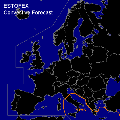
CONVECTIVE FORECAST
VALID 06Z TUE 01/02 - 06Z WED 02/02 2005
ISSUED: 31/01 23:51Z
FORECASTER: VAN DER VELDE
General thunderstorms are forecast across parts of the Mediterranean Sea, including coastal areas of Italy, the Balkan, and Turkey.
SYNOPSIS
High pressure west of Ireland causes northern flow over much of Europe. Within this flow, a cold front passes over central Europe, and the wave associated with the front will enhance at the lee of the Alps and generate further cyclogenesis over the Mediterranean.
Under strong shear conditions instability follows behind the cold front, but probably too shallow/weak to cause severe weather. Shear will also be enhanced over the Mediterranean, but instability is forecast to be outside these areas, and the resulting thunderstorms are not expected to pose any significant severe weather threat. CAPE values per GFS 12Z generally remain under 100 J/kg, but thunder is likely going to be widespread with ample synoptic scale lift from the developing wave near Greece by the end of the forecast period.
DISCUSSION
#