CONVECTIVE FORECAST
VALID 06Z MON 24/01 - 06Z TUE 25/01 2005
ISSUED: 23/01 22:41Z
FORECASTER: GROENEMEIJER
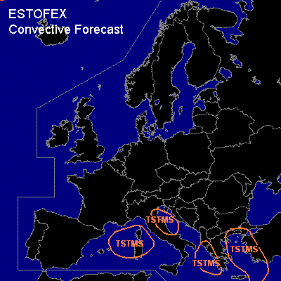
General thunderstorms are forecast across parts of the western Mediterranean Sea region, the northern Adriatic and parts of east-central Italy, the Ionean Sea, parts of the Aegean Sea region and the eastern Mediterranean.
SYNOPSIS
Monday at 06 UTC... an omega blocking pattern has its central high west of Ireland. A northerly flow is present over western Europe. A shortwave trough is expected from the northern Adriatic to northern Spain, associated with the polar front. Cyclogenesis is expected to take place over Italy during Monday . The polar air mass behind the polar flows southward over the western Mediterranean as the cold polar air flows southward. Some thunder can be expected with some of the resulting storms. Later these may affect the northern Adriatic as well. Further south and east across the Ionean Sea and the Aegean Sea region, isolated thunder may occur early Tuesday morning as the warm sector destabilises somewhat too. Severe storms are unlikely.
DISCUSSION
#