CONVECTIVE FORECAST
VALID 06Z WED 19/01 - 06Z WED 19/01 2005
ISSUED: 19/01 07:20Z
FORECASTER: GROENEMEIJER
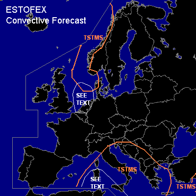
General thunderstorms are forecast across Central and southern Italy, the Tyrrhenean Sea, the Adriatic Sea, the western and southern Balkans, Greece, the Aegean Sea as well as western Scandinavia and the northeastern North Sea.
SYNOPSIS
Wednesday at 6Z...a northwesterly jet is located over the British Isles into France and the western Mediterranean. A low-pressure area is located over central Italy. A warm front over Ireland moves quickly eastward, reaching a line approximately from Copenhagen to Lyon on Thursday morning.
DISCUSSION
...Italy...
A cold front is analyzed from the central Adriatic to central Tunisia. Strong rising motions are expected over the front per GFS. The front is and will likely continue to be accompanied by thunderstorms, that will likely form behind the front as well.
Over western Sicily, Sardinia and the western Tyrrhenean Sea, low-level vertical wind shear is rather strong so that despite the low instability a small chances of severe weather will be present, mainly in the form of severe winds. Especially there, but also elsewhere along the front, a few brief marginal severe events are possible, but a risk category is not needed. The front is expected to reach the western Aegean Sea and western Crete on Thursday morning.
...Netherlands, North Sea...
The Irish warm front is quickly overtaken by a cold front. The occlusion point is expected to track from Scotland (15Z) into west-central Germany (6Z). Shallow, linearly organized convection is likely in the very strongly sheared environment behind the occlusion/cold front early on Thursday morning. In association with this convection a few severe gusts and perhaps even a tornado may occur. Overall threat however is too low for a risk category. Threat may continue into Germany, Denmark later on Thursday.
#