CONVECTIVE FORECAST
VALID 06Z MON 17/01 - 06Z TUE 18/01 2005
ISSUED: 17/01 04:39Z
FORECASTER: GROENEMEIJER
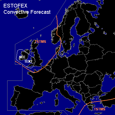
General thunderstorms are forecast across the British Isles and across the Channel, the North Sea and their coasts as well as the Aegean Sea, parts of Greece, southern Turkey and most of the eastern Mediterranean Sea.
SYNOPSIS
Monday at 06 Z... a southwesterly flow is located over the northern Brtish Isles and western Scandinavia, while a strong westerly jet approaches western Europe from the Atlantic. An ENE-WSW oriented ridge stretches roughly from the Baltic States to the western Mediterranean. A vertically stacked low pressure area has its centre near Crete and moves slowly eastward.
DISCUSSION
...Ireland, Wales and southwestern England...
A polar air-mass that is unstable to above 500 hPa is expected to overspread the British Isles from the west as a cold front reaches Ireland shortly before noon onward. Upward motion in the left exit of the aformentioned jet enhances destabilisation and provides ample shear for (linearly) organized convection along and behind the front. Given that low-level shear is maximized across Ireland, southwestern England and Wales it is possible that some storms develop rotating updrafts. A minor risk of a tornado will exist as a result. The storms will likely continue past the end of the period as a new trough reaches Ireland and Scotland on Tuesday morning.
#