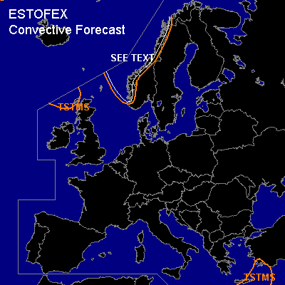

CONVECTIVE FORECAST
VALID 06Z THU 06/01 - 06Z FRI 07/01 2005
ISSUED: 05/01 17:46Z
FORECASTER: GATZEN
General thunderstorms are forecast across northwestern Europe
General thunderstorms are forecast across northeastern Mediterranean
SYNOPSIS
North of strong high over SW Europe, a deep southwesterly flow is present over northeastern Atlantic and northwestern Europe. Several short-wave troughs embedded in the strong current affect northwestern and northern Europe. The eastern part of Europe is dominated by relatively low geopotential.
DISCUSSION
...Northwestern Europe
...
Strong upper jet streak W of British Isles expands eastward as upper ridge over southwestern Europe amplifies. At the leading edge of this upper jet ... axis of intense short-wave trough moves northeastward ... and is expected from central Scandinavia to Poland on Thursday, 00Z. In the range of upper short-wave trough ... strong DCVA is forecast from northern North Sea to northwestern Scandinavia. Affected maritime airmass is characterized by relatively high theta-e values and convective mixing as indicated by several thunderstorms over northern British Isles ATTM ... and GFS model output suggests CAPE of some 100 J/kg during the forecast period. Showers and thunderstorms are forecast to spread northward west of Scandinavia. Although deep vertical wind shear will be low in the range of the trough axis ... enhanced low-level SRH-values near the Scandinavian coast may be sufficient for rotating updrafts. Rather low LCL heights will be present and one or two brief tornadoes are not completely ruled out. Allover thread should be marginal.
#