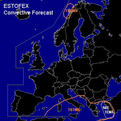

CONVECTIVE FORECAST
VALID 06Z WED 29/12 - 06Z THU 30/12 2004
ISSUED: 29/12 09:53Z
FORECASTER: GROENEMEIJER
General thunderstorms are forecast across the south-central Mediterranean region, the Aegean Sea and western Turkey as well as in an area along the west coast of Norway.
SYNOPSIS
Wednesday at 06Z ... a longwave trough is located over central Europe and the central Meditarranean. A broad ridge is located to the west of Portugal. In the evening a strong jet moves over the northern British Isles into western Scandinavia.
DISCUSSION
...western Turkey, eastern Aegean Sea...
At 06 Z... a shortwave was located over the Ionean Sea. The trough is expected to move eastward and be located over western Turkey at 18Z. Ahead of the trough, a cold front is present preceded by a southerly low level jet that advected warm, moist air northward. A few thunder storms may form along and ahead of the front. Given that low-level and deep-layer shear is strong, storms may well develop rotating updrafts. However, storm coverage and instability should be rather low, so that a categorical risk does not seem warranted. Nevertheless, a small risk of a tornado, wind or hail exists.
#