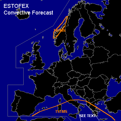

CONVECTIVE FORECAST
VALID 09Z FRI 10/12 - 06Z SAT 11/12 2004
ISSUED: 10/12 09:23Z
FORECASTER: GATZEN
General thunderstorms are forecast across southern and central Mediterranean
General thunderstorms are forecast across western Norway
SYNOPSIS
South of high over central Europe ... a cut-off low moves eastward over central Mediterranean. Moist and unstable airmass is present in the range of this feature.
DISCUSSION
...Central Mediterranean
...
Quite intense thunderstorms that formed during Thursday have merged into a quasi stationary MCS west of Greece. This MCS has formed at the leading edge of dry airmass south of low surface pressure over central Mediterranean. To the east ... a tongue of relatively warm airmass is present west of Greece ... characterized by steep low-level lapse rates and around 12 C dewpoint in the lowest km ... resulting in CAPE of several hundred J/kg and almost no CIN as indicated by latest LIBR sounding. On Friday ... QG forcing is expected to remain in the range of the low-level boundary as some DCVA and weak WAA should be in place at the cyclonic flank of upper jet streak traveling eastward over extremely southern Mediterranean ... and thunderstorms should go on during the next hours. Although deep layer wind shear will be rather weak ... quite strong low level wind shear with easterly surface winds west of Greece and up to 15 m/s southerly winds at 900 hPa should be sufficient for organized convection. Multicells and embedded supercells are not ruled out during the next hours ... and severe wind gusts, isolated large and a tornado or two due to low LCL heights and high low-level SRH values are not ruled out. Chance for severe weather should decrease during the day as upper forcing is expected to weaken. Allover threat seems to be too low to warrant a categorical risk, though.
#