CONVECTIVE FORECAST
VALID 06Z TUE 07/12 - 06Z WED 08/12 2004
ISSUED: 07/12 00:36Z
FORECASTER: VAN DER VELDE
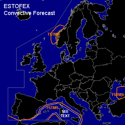
General thunderstorms are forecast across the western Mediterranean Sea, the Black Sea, and the western Norwegian coast
SYNOPSIS
The low pressure system over the southwestern Mediterranean is gradually deepening and the advection of warm air is established.
A cold front will move over the Black Sea and instability at and behind the front is expected to be large/deep enough that thunderstorms can develop.
Open cell convection in the maritime polar airmass near the west coast of Norway may be weakly electrified.
DISCUSSION
...western Mediterranean Sea...
The area has seen considerable convective activity the last few days. GFS and NMM models indicate that the convergence zone and the instability will shift a little northward. Overall gentle winds and little shear along with significant low level instability indicates some potential for waterspouts, especially at the convergence line following the sfc theta-e ridge. Low level vertical shear values are generally expected to remain under 10-15 kts 0-1 km, and also deep layer shear is not strong, so they are likely harmless. Nevertheless, small hail up to 1-2 cm will be possible.
#