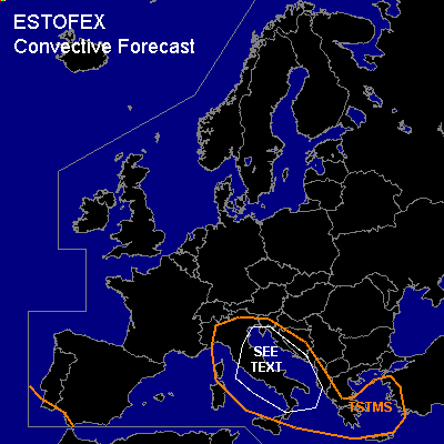
CONVECTIVE FORECAST
VALID 06Z TUE 30/11 - 06Z WED 01/12 2004
ISSUED: 29/11 22:49Z
FORECASTER: VAN DER VELDE
General thunderstorms are forecast across the central Mediterranean Sea, Adriatic Sea, Ionean Sea and Aegean Sea, broadly including their coasts.
SYNOPSIS
A low pressure system is situated near northwestern Italy. Relatively warm air is advected northward ahead of the cold front, that is forecast to move over Italy during the early morning.
DISCUSSION
...SEE TEXT area...
The GFS and NMM models do not forecast significant amounts of CAPE in this airmass, the EL being generally below the -20C level. But given some modest lightning activity the previous day over the western Mediterranean, we can expect some (embedded/elevated) thunderstorms forming in or ahead of the frontal zone, where synoptic UVMs are strong and profiles are likely nearly saturated. SREH and deep layer shear are expected to be moderate to strong, low level shear may be moderate. Some of the convection could profit from it and briefly develop rotating updrafts, that may induce an isolated tornado or waterspout.
#