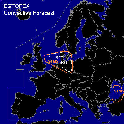
CONVECTIVE FORECAST
VALID 06Z MON 22/11 - 06Z TUE 23/11 2004
ISSUED: 22/11 01:29Z
FORECASTER: GROENEMEIJER
General thunderstorms are forecast across parts of the North Sea, southern Scandinavia, the northern Netherlands and northern Germany as well as over the western Black Sea and a part of northwestern Turkey.
SYNOPSIS
Monday at 06Z... a deep longwave trough over the Ukraine and western Black Sea moves eastward. A westnorthwesterly jet over the central British Isles into the Low Countries moves eastward and trough west of Norway moves southeastward. An east-west oriented cold front north of Scotland accelerates southward over the North Sea as a cyclone quickly deepend over southern Scandinavia.
DISCUSSION
...see text area...
Strong 10-15 m/s low-level wind shear and atrong upward motions can be expected in the warm sector of the developing cyclone over southern Scandinavia. ahead of the surface cold front, that moves southeastward over the North Sea, some latent instability/CAPE may form and convection -probably organized in convective lines- is likely. Strong wind gusts may result. Some convection may be thundery and the strong low-level shear may cause a few mesocyclones to form. In that case, severe gusts and a tornado or two may be possible.
#