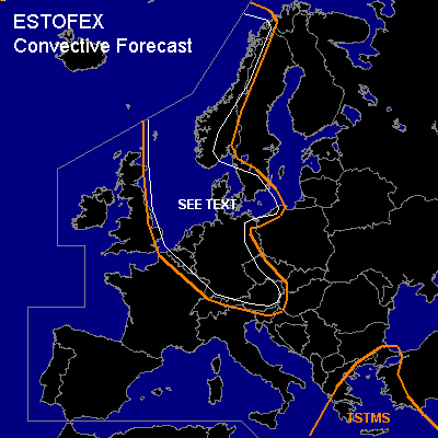

CONVECTIVE FORECAST
VALID 06Z FRI 19/11 - 06Z SAT 20/11 2004
ISSUED: 18/11 16:45Z
FORECASTER: GATZEN
General thunderstorms are forecast across North Sea, southern Scandinavia, southern Baltic Sea, Benelux, parts of Germany and Austria
General thunderstorms are forecast across eastern Mediterranean
SYNOPSIS
Well developed upper trough over Scandinavia expands into eastern and central Europe as very strong upper jet streak moves SE-ward over central Europe. At lower levels ... a intense cyclone is expected to form along a frontal boundary over western Europe during the next hours reaching Belarus at the end of the forecast period. North of associated cold front ... cold air mass will spread SE-ward into the central parts of Europe.
DISCUSSION
...North Sea, southern Scandinavia, southern Baltic Sea, Benelux, parts of Germany and Austria
...
Cold maritime airmass is expected over the warm water surface of North and Baltic Sea ... resulting in convective activity during the forecast period. Although amount of instability is expected to be very limited due to rather dry cold low level airmass ... short-wave troughs that are embedded in the strong northwesterly flow should lead to sufficient synoptic forcing ... and some thunderstorms are forecast. Rather strong surface pressure gradient is expected ... and showers/thunderstorms will likely capable of producing severe wind gusts. If convection will organize into bow echoes ... an upgrade will be necessary. However ... overall threat of organized convection seems to be quite low ATTM.
#