CONVECTIVE FORECAST
VALID 11Z WED 17/11 - 06Z THU 18/11 2004
ISSUED: 17/11 11:30Z
FORECASTER: GROENEMEIJER
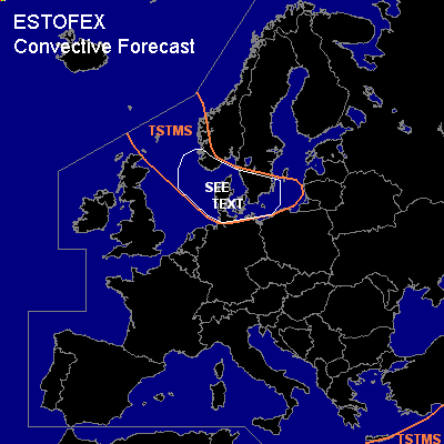
General thunderstorms are forecast across southern Scandinavia, the northeastern North Sea and the western Baltic Sea as well as a part of the eastern Mediterranean Sea
SYNOPSIS
Wednesday at 12Z... a strong westerly jet over the North Atlantic has its exit region over the northern British Isles. A wave in the accompanying frontal zone is expected to develop into a quite intense surface cyclone that moves eastward over the central North Sea and reaches southern Sweden on Thursday morning. Over eastern Europe, unstable air is present ahead of a weak northeast-southwest oriented trough over western/central Turkey.
DISCUSSION
...North Sea, southern Scandinavia...
Within the polar air mass present to the west of the developing surface cyclone, (lines of) convective storms are forecast, that are occasionally accompanied by thunder. Very strong (25 m/s) 0-1 km shear indicates that short-lived mesocycones are possible and therefore very strong wind gusts and perhaps a tornado are possible. Low-level storm-relative helicity, however, is not very high, so the overall threat of mesocyclone-related severe weather is thought to be relatively small. The strong gradient wind field, however, may become sufficiently strong to cause damage.
#