CONVECTIVE FORECAST
VALID 06Z MON 15/11 - 06Z TUE 16/11 2004
ISSUED: 15/11 05:45Z
FORECASTER: GROENEMEIJER
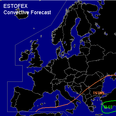
There is a slight risk of severe thunderstorms forecast across southwestern Turkey and the eastern Aegean Sea
General thunderstorms are forecast across the southern and eastern mediterranean and across the eastern Balkans.
SYNOPSIS
Monday at 06Z... a mid/upper level low pressure system over the western Mediterranean Sea moves rapidly eastward and reaches the southwestern Balkans on Tuesday morning. A north-south oriented cold front is expected over the eastern Aegean Sea and move eastward.
DISCUSSION
...Turkey, Aegean Sea...
Ahead of the cold front, very strong (>20 m/s) 0-1 km wind shear was observed in Izmir and Isparta at 00Z and high (400-500 m2/s2) 0-3 km storm-relative helicity were observed. Some forcing for upward motions is forecast over the Turkish mainland. Latent instability was barely present in the aformentioned soundings, but both GFS and NMM produce some CAPE and a few thunderstorms indicate that some instability is in fact present - although possibly elevated. As the storms occur in the strongly sheared environment described above and are expected to continue during the forecast period, a few rotating updrafts are likely. Strong wind gusts and perhaps one or two tornadoes are possible as well as some large hail locally.
#