CONVECTIVE FORECAST
VALID 06Z SUN 07/11 - 06Z MON 08/11 2004
ISSUED: 06/11 23:50Z
FORECASTER: VAN DER VELDE
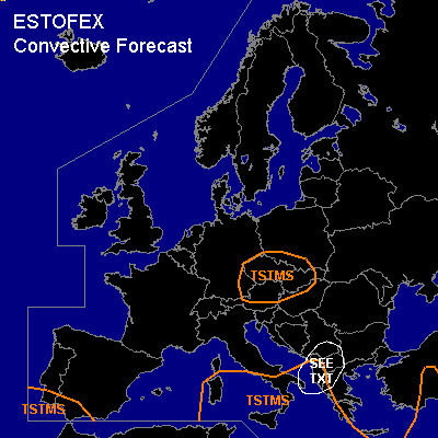
General thunderstorms are forecast across the central Mediterranean Sea, Srn Italy, SWrn Balkan, central Europe
SYNOPSIS
Between a high pressure area over the Atlantic Ocean and a developing low southwest of the Balkan, cold air is transported southward over most of Europe. A tongue of high theta-e at low levels is associated with the sfc low between Greece and Italy and the focus for convective activity. Near the center of the upper low over central Europe, enhanced instability may also be enough to create a few thunderstorms.
DISCUSSION
...Albania and surroundings...
Ascending motions assciated with cyclogenesis processes and upslope advection of moist, slightly unstable Mediterranean air is forecast by GFS and NMM models to result in more than 50 mm of rainfall, which could lead to flash flooding in some areas. WAA generates also SREH values of 100-150 m2/s2 and deep layer shear of about 17 m/s where CAPE indicates potential for marginal deep convection. Clustered embedded thunderstorms seem likely in the frontal wave, possibly a few containing short-lived rotation in the updrafts. This may cause some marginally large hail and perhaps, in combination with with low LFCs, a weak tornado.
#