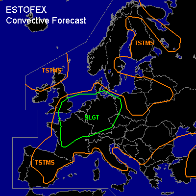

CONVECTIVE FORECAST - UPDATE
VALID 11Z SAT 17/07 - 06Z SAT 17/07 2004
ISSUED: 17/07 11:45Z
FORECASTER: HAKLANDER
There is a slight risk of severe thunderstorms forecast across SE-England, and across the areas mentioned in the previous outlook
SYNOPSIS
The reader is referred to the previous outlook.
DISCUSSION
...SE-England...
Convective activity has become stronger than expected, possibly because of low-level advection of high theta-e air from N'rn France. With deep-layer shear of 15-20 m/s, cells might organise into multicells, possibly with some embedded supercells. Storms could produce large hail, severe wind gusts and even a tornado, because of the low LCLs and marginal wind shear.
#