CONVECTIVE FORECAST - UPDATE
VALID 16Z MON 07/06 - 06Z TUE 08/06 2004
ISSUED: 07/06 16:37Z
FORECASTER: GROENEMEIJER
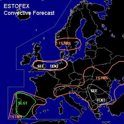
General thunderstorms are forecast across the Iberian peninsula, southern Scandinavia, northern Germany and northern Netherlands Wales and perts of England, the Alps, the Balkans, southeastern Poland, the Slovak Republic and much of the Ukraine
SYNOPSIS
ref. conv. forecast.
DISCUSSION
...Wales, England, Netherlands, northwestern and northern Germany,...
Capping has proven to be weak across northwestern Germany where scaterred thunderstorms have formed. A few additional storms could develop within a Cu field over the central and eastern Netherlands. Another area of possible thunderstorm development in the next few hours is across Britain near a line from Holyhead to Hull, where weak surface convergence is taking place and the cap should almost have been eroded by now given surface temperatures near 25C and surface dew points of 15-17 C. Scattered storms over those areas are likely to be of a multicellular nature and will be capable of producing a few large hail events and possibly a few strong but likely sub-severe wind gusts. Overall threat seems not to require a risk category at this moment as storm coverage is expected to remain quite limited.
#