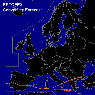
CONVECTIVE FORECAST
VALID 06Z SAT 15/05 - 06Z SUN 16/05 2004
ISSUED: 14/05 22:08Z
FORECASTER: DAHL
General thunderstorms are forecast across the southern Mediterranean regions.
SYNOPSIS
Upper long-wave ridge over the E Atlantic is expected to build northeastwards and cover much of central and western Europe at the end of the pediod. At the E periphery of the ridge ... short-wave trough expected over S Scandinavia on Saturday 00Z is progged to eject into the N Balkan States during the period. Weak quasi-stationary vort max is present over the SW Mediterranean Sea/SE Iberia.
DISCUSSION
...S Iberia...
Scattered TSTMS will likely form again over SW Spain beneath upper thermal trough. Also ... TSTMS should develop over the Atlas Mountains ... and may advect off the higher terrain across the extreme SW Mediterranean Sea and south Spain. Deep/dry CBL's suggest that a few strong wind gusts will be possible.
Otherwise ... insolation/orographic forcing will likely promote scattered TSTM development across the southern Mediterranean regions in weakly capped and weakly unstable air mass. Given minimal shear ... severe threat should be negligible with this activity. Isolated TSTMS may also develop N of the TSTM area over Italy ... and maybe as far north as Romania. If coverage of these TSTMS is greater than currently anticipated ... a northward extension of the thunderstorm area may be necessary.
#