CONVECTIVE FORECAST - UPDATE
VALID 15Z MON 03/05 - 06Z TUE 04/05 2004
ISSUED: 03/05 14:00Z
FORECASTER: GROENEMEIJER
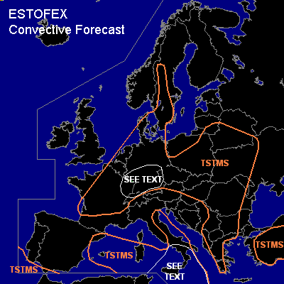
General thunderstorms are forecast across see convective forecast
SYNOPSIS
see convective forecast
DISCUSSION
...Benelux, Germany, eastern France...
Only a few 100's of J/kg MLCAPE will likely form over the eatern Benelux and NW Germany as boundary layer moisture seems to have been slightly overestimated in the convective forecast. The current convective activity over central Germany has low chances of becoming severe, as 12Z observations show weak wind shear, which is expected to improve not before well after sunset. Over southern Germany shear is stronger (up to ~ 20 m/s 0-6 km shear), and a few 100's of J/kg MLCAPE seems to be present according to the 12Z soundings. However, it seems questionable how much deep convection will develop there at all. Increasing middle and high level cloud cover are a negative factor in this respect. If convection is able to form a few supercells are possible with a main thrat of large (2-4 cm) hail. Storm coverage is expected to be too low to warrant a risk category.
#