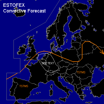
CONVECTIVE FORECAST
VALID 07Z FRI 30/04 - 06Z SAT 01/05 2004
ISSUED: 30/04 07:41Z
FORECASTER: GATZEN
General thunderstorms are forecast across Central, western and eastern Europe, Mediterranean
SYNOPSIS
Closed upper level low has formed over southwestern Europe. To the east ... weak ridge is present over southeastern Europe. Between these two systems, warm and moist airmass remains over central and southeastern Europe and central Mediterranean. At low levels ... low pressure system is forecast over western France ... with a cold front extending from southern England to southwestern Germany. Widespread diurnal convective activity can be expected during the forecast period, as several vorticity maxima and relatively unstable airmass are present over the forecast area.
DISCUSSION
...Benelux, western and southwestern Germany...
Along and ahead of the cold front ... rather moist airmass is present over Germany/ Benelux. During the day ... some insolation is expected ... and airmass should become unstable with CAPE in the order of 400 J/kg. Showers and thunderstorms are forecast. Moderate low level wind shear will be present over the northern portions of the affected region, while deep layer wind shear will be rather weak increasing to the west. Some thunderstorms may be strong and mesocyclones may form if SRH will be enhanced. North of the Alps ... chance for isolated large hail will be enhanced as mid-level steep lapse rates should form due to föhn. However ... overall threat of severe weather seems to be too low to warrant a SLGT RISK. Best chances for thunderstorms will be along the front.
#