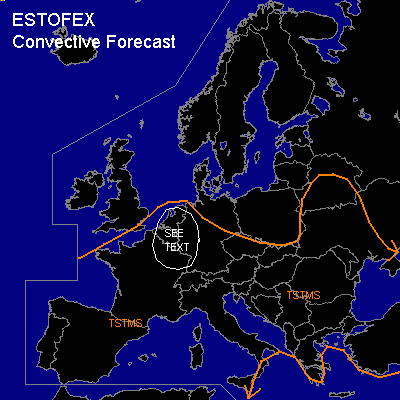

CONVECTIVE FORECAST
VALID 06Z TUE 27/04 - 06Z WED 28/04 2004
ISSUED: 27/04 22:06Z
FORECASTER: GROENEMEIJER
General thunderstorms are forecast across Much of west-central, southwestern and central Europe
General thunderstorms are forecast across parts of Turkey
General thunderstorms are forecast across parts of the Russian Federation
General thunderstorms are forecast across parts of Turkey
SYNOPSIS
Wednesday at 06... a vertically stacked low is expected to be located over western France. A relatively weak westerly jet streak on its southern flank is expected to rotate into southwestern and central France.
DISCUSSION
...France, Benelux...
About 400-800 J/kg MLCAPE should be able to form over the Benelux countries and northern France as diurnal heating destabilises the air-mass. Quite extensive cloudiness is expected to limit destabilisation over south-central France, while drier and cooler maritime air is expected to limit destabilisation in western France. As the aformentioned jet streak moves northward, a small area of relatively strong deep layer shear / 15-25 m/s / may coincide with some MLCAPE in the area marked "see text". Uncertainty whether this will actually be realised and relatively benign forcing for upward vertical motion makes that a slight risk will not be issued at this moment.
Further north, over northern France and the Benelux countries shear will be smaller, but MLCAPE will likely become higher. A few large hail events and strong, but likely sub-severe gusts will be possible here.
#