CONVECTIVE FORECAST
VALID 06Z FRI 16/04 - 06Z SAT 17/04 2004
ISSUED: 15/04 22:35Z
FORECASTER: GROENEMEIJER
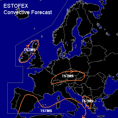
General thunderstorms are forecast across parts of Spain, the western Mediterranean, southern Italy, the southwestern Balkans as well as parts of central Europe, Ireland and Scotland.
SYNOPSIS
Friday at 06Z... a southwesterly jet is located from Algeria into the western/central Mediterranean area. A surface cyclone has formed east of Spain. An associated cold front is expected approximately from the Baleares southward. Ahead of the front, an elevated mixed layer is being advected into the central Mediterranean, creating some slight instability, especially just ahead of the cold front. Strong upward vertical motions and high precipitation rates are expected over western Italy, the Tyrrhenean Sea, the western Mediterranean and eastern Spain. This may cause flooding in places. Thunderstorms are expected to occur near the low's centre and near a back-bent occlusion over east-central Spain and along the cold front or just ahead of it in the warm sector. These storms are expected to move eastward during the period, affecting southern Italy later on. Deep-layer shear is forecast to be moderate within the warm sector and decreasing during the forecast period, so that the (pre)frontal storms will generally not be severe.
DISCUSSION
#