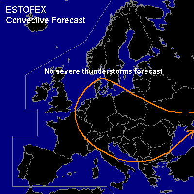

CONVECTIVE FORECAST
VALID 06Z WED 07/04 - 06Z THU 08/04 2004
ISSUED: 06/04 17:28Z
FORECASTER: GATZEN
General thunderstorms are forecast across Central and eastern Central Europe
SYNOPSIS
Broad upper long-wave trough placed over Europe. Several vort-maxima rotate along the periphery of its center, that is situated over northern Germany. Intense vort-max attm over Great Britain is expected over southeastern Central Europe tomorrow. Today's soundings indicate cold but unstable airmass in the range of the main trough. Over the Mediterranean ... quite strong westerly flow will remain. Underneath the anticyclonic flank of the upper jet ... soundings indicate well developed inversions over the Mediterranean.
DISCUSSION
...Central Europe...
Strong vort-maximum will travel along the southern and eastern flank of the main trough during the forecast period, leading to cyclogenesis along the cold front over the northern Balkans. Today's soundings indicate that the airmass ahead of this cold front is characterized by low-level steep lapse rates due to diurnal heating and an inversion at about 700 hPa. It is questionable if tomorrows instability will be sufficient for thunderstorms along the cold front. Synoptic forcing will be quite strong as vort-max and associated negatively tilted trough will move northwards over eastern Central Europe. However, expected scenario is that stratiform mid-level clouds could inhibit insolation substantially limiting the potential for thunderstorms somehow. Along the cold front ... narrow band of convection is expected, and some lightning strikes should occur. Moderate low-level wind shear and relatively weak deep layer shear are forecast, and overall threat of severe organized convection should be quite low. To the west ... relatively well-mixed airmass will remain in the range of the upper trough. Daytime insolation should lead to sufficient destabilization, and CAPE up to 200 J/kg may be possible referring to latest soundings. Focus of convective activity is expected underneath the vorticity-maxima travelling in the range of the main trough. Although low-level lapse rates may be quite steep ... weak vertical wind shear and rather weak upper forcing is expected ... and severe thunderstorms should be not likely. Soft hail should occur due to rather cold airmass.
#