CONVECTIVE FORECAST
VALID 06Z TUE 06/04 - 06Z WED 07/04 2004
ISSUED: 05/04 22:39Z
FORECASTER: HAKLANDER
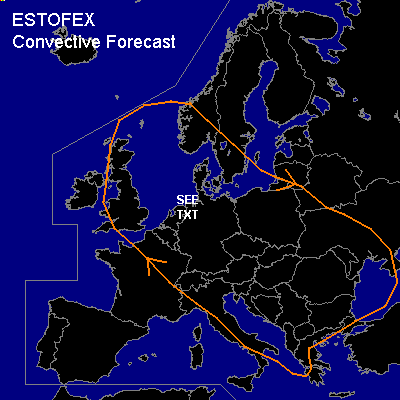
General thunderstorms are forecast across the UK, much of CNTRL, ERN Europe and the Balkan.
SYNOPSIS
A quasi-stationary planetary wave pattern across NRN and CNTRL Europe should amplify during the forecast period. In between an NRN-Atlantic and a Finnish upper high, an elongated ULL across the Norwegian and North Sea focusses near the German-Danish border, where it lingers during the forecast period and is vertically aligned with a low at the surface. Several lines of increased relative vorticity at mid-levels spiral around this ULL.
DISCUSSION
...NRN Germany, Denmark, and the Netherlands...
Conditions may become favorable for spouts, with positive SBCAPE and very moist profiles, even up to mid-levels. Especially during the day, the enhanced relative vorticity in the boundary layer may be spun up by rising thermals and (coastal) convergence lines. Since vertical wind shear will be low near the low pressure centre, turbulent mixing of heat, moisture and relative vorticity might be low enough for this vortex stretching to result in a few spouts. Within the polar air mass, relatively low freezing levels of 800-900 m AGL (and hence low WBZ heights) increase the probability of hail. Because CAPE will be only marginal and vertical wind shear is small, large hail of 2+ cm diameter seems unlikely.
...CNTRL/NRN Italy, Hungary, NWRN Balkan...
Near the baroclinic zone, about 20-25 m/s deep-layer vertical wind shear might yield more organized thunderstorms where 100-200 J/kg MUCAPE should be present. Chances for large hail are increased due to vertical wind shear, but owing to insufficient CAPE, the risk appears too small for a SLGT.
...Iberian Peninsula...
According to Mondays GFS18Z run, diurnal heating could yield upto 500 J/kg of MUCAPE with negligible MUCIN at TUE/18Z across interior parts of SRN Spain (Cordoba area) and Portugal. The associated forecast surface dew points of 14°C appear too high and the forecast moist layer is restricted to a very shallow layer. Furthermore, a stable layer that was visible on Mondays 12Z soundings near 850 hPa appeared much less distinct in GFS model data. We therefore do not expect any thunderstorms across the Iberian Peninsula during the FCST period.
#