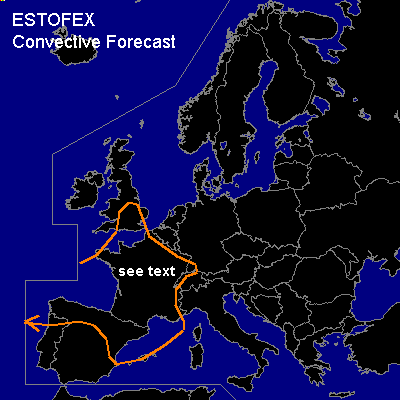

CONVECTIVE FORECAST
VALID 10Z FRI 02/04 - 06Z SAT 03/04 2004
ISSUED: 02/04 09:28Z
FORECASTER: DAHL/GATZEN
General thunderstorms are forecast across W and W-central Europe
SYNOPSIS
Omega flow pattern present over Europe .... with a ridge over Scandinavia and intense troughs over eastern and extremely western Europe. At lower levels ... cold front streching from E british Isles across France into the W Mediterranean attm is expected to stall over western central Europe.
DISCUSSION
...W and W-central Europe ...
Looks that cellular convection in the wake of the cold front expected to stretch from the E british Isles across France into the W Mediterranean by Friday midday ... will spread into W and W-central Europe during the day ... supported by daytime heating. Mean upper flow will weaken per model guidance ... but near vort maxima ... 60 knots deep shear may be present ... supporting threat for isolated short lines/bows and possibly a few small supercells ... with an attendant threat for marginally severe wind/hail ... and maybe a brief tornado or two given low LCL heights and complex orography over portions of the region ... capable of modifying low-level shear profiles. However ... majority of the cells will likely be short-lived and non-severe ... and a SLGT is not necessary.
#