CONVECTIVE FORECAST
VALID 06Z MON 29/03 - 06Z TUE 30/03 2004
ISSUED: 29/03 00:53Z
FORECASTER: GROENEMEIJER
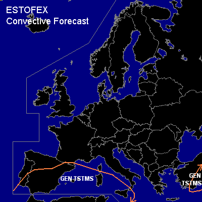
General thunderstorms are forecast across southern, central and eastern Spain, the western Mediterranean and parts of Turkey.
SYNOPSIS
A few thunderstorms will likely locally be present near the warm front and be of an elevated nature. Other storms coincident with the cold front will likely affect northern Algeria and Tunesia and move over the Mediterranean after 15Z and become elevated in nature. They may affect Sardinia and Siciliy at the end of the forecast period. Severe weather is not anticipated with the storms because of their elevated nature, low instability, and moderate wind shear in the cloud-bearing layer. A few shallow thunderstorms will likely be ongoing near the low's center near the strait of Gibraltar and over Algeria and Tunisia. In response to solar heating, some storms will likely form over southern and possibly central Spain during the late morning and early afternoon. As the low's center moves northeastward along the Spanish east coast, the center of thunderstorm activity will likely shift accordingly. Given that the LCL height is forecast to be low near the center of the system and given the presence of abundant vorticity at low levels, a few waterspouts could very well occur along the Spanish east coast.
DISCUSSION
...Spain, western Mediterranean...
A few thunderstorms will likely locally be present near the warm front and be
of an elevated nature. Other storms coincident with the cold front will likely affect
northern Algeria and Tunesia and move over the Mediterranean after 15Z and become
elevated in nature. They may affect Sardinia and Siciliy at the end of the forecast period.
Severe weather is not anticipated with the storms because of their elevated nature,
low instability, and moderate wind shear in the cloud-bearing layer.
A few shallow thunderstorms will likely be ongoing near the low's center near
the strait of Gibraltar and over Algeria and Tunisia.
In response to solar heating, some storms will likely form over southern and possibly
central Spain during the late morning and early afternoon.
As the low's center moves northeastward along the
Spanish east coast, the center of thunderstorm activity will likely shift accordingly.
Given that the LCL height is forecast to be low near the center of the system and given
the presence of abundant vorticity at low levels, a few waterspouts could very well occur
along the Spanish east coast.
...Turkey...
An upper trough associated with a cold front at the surface works its way eastward over the Black Sea region. To the north, no or almost no CAPE is expected be present. Solar heating over the Turkish mainland may prove to be sufficient for some CAPE to form and the passage of the cold front over southern and eastern parts may be accompanied a few thunderstorms.
The storms, if any, are not expected to be severe, given that CAPE will be low. A few stronger gusts may however occur.
#