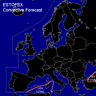

CONVECTIVE FORECAST
VALID 06Z WED 10/03 - 06Z THU 11/03 2004
ISSUED: 10/03 04:56Z
FORECASTER: GROENEMEIJER
General thunderstorms are forecast across the southwestern mediterranean and northern Turkey.
SYNOPSIS
Wednesday at 06Z... a high-over-low blocking pattern is located over western Europe. South of the low, a western flow is present ver the Mediterranean. Embedded within this flow is a shortwave over northwestern Turkey that is expected ot move eastward during the forecast period. A weak shortwave located over northwestrn Spain is expected cross the peninsula and track eastward over the western Mediterranean after 18Z. Slight rising motions and instability may cause some thunderstorms to form in the indicated region during evening hours and/or overnight. No severe weather is expected with these storms.
DISCUSSION
...Turkey...
Near the shotwave moving eastward over northern Turkey, a few storms will likely be ongoing and move eastward. The activity is not expected to become intense as only very limited instability is expected to develop. Nevertheless, moderate low-level and deep-layer shear profiles and strong forcing can cause the storms to locally organise so that some stronger gusts may occur that will however remain well below the severe limit of 25 m/s.
#