
CONVECTIVE FORECAST
VALID 06Z MON 08/03 - 06Z TUE 09/03 2004
ISSUED: 08/03 02:38Z
FORECASTER: GROENEMEIJER
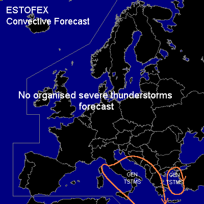
General thunderstorms are forecast across Central and southern italy, the Adriatic, the extreme western and southern Balkans, parts of Greece and western Turkey, the eastern Aegean Sea.
SYNOPSIS
Monday at 06 Z.... a ridge is located near 10 W. Downstream, a deep trough is located over the central Mediterranean. A northwesterly jet streak is expected to round the base of the trough and Q.G. forced ascent in its left exit region is forecast to influence southern Italy and the southern Balkans during this forecast period. Initially, thunderstorms are expected to be ongoing both near an eastward surging cold front over southern Italy and to the northwest of the frontal zone in a deep slightly unstable air mass.
Severe storm activity is not expected, although a few stronger gusts may occur over Greece and Albania near and after the passage of the cold front.
DISCUSSION
#