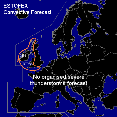

CONVECTIVE FORECAST
VALID 06Z WED 03/03 - 06Z THU 04/03 2004
ISSUED: 03/03 00:51Z
FORECASTER: GROENEMEIJER
General thunderstorms are forecast across the western and southwestern United Kingdom and Ireland
SYNOPSIS
Wednesday at 06Z... a ridge is located from Western Iberia to the Channel Region to the North Sea. An elongated trough is located from the Balkans into Algeria. A westerly mid/ upper jet is expected to move eastward over the Atlantic, so that its exit region will become situated over the Low Countries on Thursday morning. Neutral to slightly unstable air is expected to be advected into Ireland Wednesday afternoon and into Scotland, Wales and southern England Wednesday evening behind a frontal system. Scattered showers/storms are expected in this air-mass, that will likely produce lightning in some places, though the total amount of lightning is quite uncertain. Severe weather is not very likely.
DISCUSSION
#