CONVECTIVE FORECAST
VALID 06Z MON 01/03 - 06Z TUE 02/03 2004
ISSUED: 01/03 01:02Z
FORECASTER: GROENEMEIJER
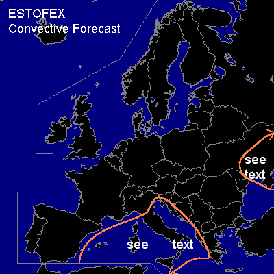
General thunderstorms are forecast across the central and western Mediterranean
General thunderstorms are forecast across southern and central parts of the Ukraine
SYNOPSIS
Monday morning at 06Z a large mid/upper level low pressure area will be located over the northwestern Mediterranean Sea, while a ridge is building over the British Isles. A westsouthwesterly jet is located south of the low-pressure area.
DISCUSSION
...western and central Mediterranean...
Cold upper-level temperatures are expected over a vast area around the mid/upper low-pressure area,
supporting scattered low-topped thunderstorms over the area.
It is not ruled out that a few rotating updrafts can form in storms
over southern Italy, the southern Adriatic and the Ionean Sea, where deep-layer shear is strongest.
Some small hail and strong gusts are possible as well as a small chance of tornadoes.
Nevertheless, these chances seem to be too small per unit area to warrant a risk category.
...southern and central parts of the Ukraine...
Some thunderstorms are expected near and behind a cold front located from the Krim
southward at 06Z, which moves eastward during the day. Given that quite
strong deep-layer shear is forecast, a few rotating storms, possibly embedded within
linearly organised convective lines, are not ruled out.
Some hail stones exceeding the limit of 2.0 cm diameter could occur locally
as well as some strong gusts.
#