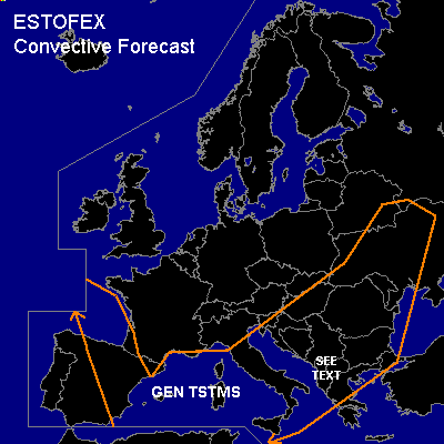

CONVECTIVE FORECAST
VALID 06Z SUN 29/02 - 06Z MON 01/03 2004
ISSUED: 29/02 03:20Z
FORECASTER: VAN DER VELDE
General thunderstorms are forecast across Gulf of Biscay, NE Spain, west/central Mediterranean, Italy, Balkan into Ukraine
SYNOPSIS
Large cut-off upper low over central Europe with cold air aloft continues providing instability over the western Mediterranean and Gulf of Biscay, while a SFC low is moving out of the northern Adriatic Sea area towards Eastern Europe. Meanwhile, a high pressure center builds up over the UK and Ireland, placing much of Europe into a northerly flow. The higher theta-e plume is moving out of the area with a wave over Romania/Ukraine.
DISCUSSION
...southwestern Balkan...
Slight instability combined with moderate-strong deep layer shear and 0-1 km shear over 20 kts with low LCLs do not exclude a brief isolated tornado if a storm may form and profit from terrain-generated helicity.
#