CONVECTIVE FORECAST
VALID 06Z FRI 20/02 - 06Z SAT 21/02 2004
ISSUED: 20/02 02:19Z
FORECASTER: VAN DER VELDE
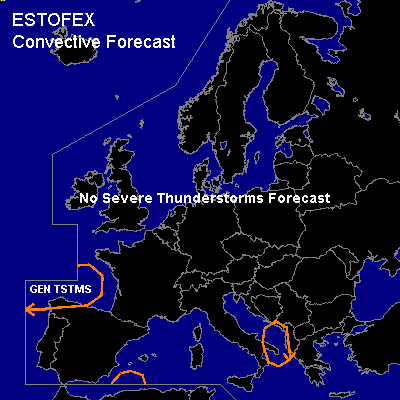
General thunderstorms are forecast across southeast Italy and Albania
General thunderstorms are forecast across northern Iberia
General thunderstorms are forecast across the western Mediterranean Sea
SYNOPSIS
Surface high pressure axis shifts from Scotland-Poland towards a center over Romania, while a upper low slips westwards at the southern flank. By the end of the period, the high has eroded over the North Sea so that SFC low pressure in the south connects with the low pressure over northern Scandinavia, giving way to fronts heading for western Europe. Temperature contrast increases as cold air from Russia drifts southward, while a plume of relatively high theta-e is being pulled up northward into France at the east side of the low over Iberia.
DISCUSSION
...southeast Italy and Albania...
some remaining instability (see previous day) occasionally enough for thunder. Will diminish under influence of subsidence of building high pressure towards noon on Friday.
...northern Iberia...
some remaining instability (see previous day) with instability deep enough for thunder, below the upper low, preferrably near vort maxima.
...the western Mediterranean Sea...
Advection of warm air from the Sahara at the east side of the low over Iberia will cause mostly elevated instability to develop. With small cap and plenty of ascending motion associated with a short-wave trough swinging around the upper low, expect some thunderous activity Saturday morning.
#