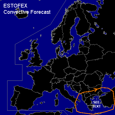

CONVECTIVE FORECAST
VALID 06Z THU 12/02 - 06Z FRI 13/02 2004
ISSUED: 12/02 00:47Z
FORECASTER: VAN DER VELDE
General thunderstorms are forecast across the northeastern Mediterranean
SYNOPSIS
Strong high pressure over Western Europe keeps most of Europe free of deep convection, while at its east flank cold air is rapidly sinking southward into the northeastern Mediterranean. A deep upper low (500 hPa @ <512 dam) is cut off and will linger over the eastern Balkan.
DISCUSSION
...Northeastern Mediterranean...
Convergence at the apex of the low level cold air and WAA towards the SFC low superposed with an upper level vorticity max will cause the SFC low to deepen as it swings over western Turkey, enhancing inflow of relatively high theta-e air from the south. This destabilisation and low level instability over sea (more than 30 deg C difference between SST and air temperature at 1 km) will allow shallow convection (tops around 650 hPa level, but above the -20C level), with thunder very well possible given the forcing.
Given very steep low level lapse rates, low LFCs and ample low level instability, with low 0-1 km vertical windshear and high vorticity, chances for waterspouts seem enhanced for the coastal waters of Turkey and Greece, especially near the center of the SFC low.
#