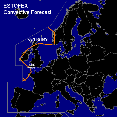

CONVECTIVE FORECAST
VALID 06Z FRI 06/02 - 06Z SAT 07/02 2004
ISSUED: 06/02 00:53Z
FORECASTER: VAN DER VELDE
General thunderstorms are forecast across coastal areas of the British Isles, Norway and Bretagne
SYNOPSIS
An old low near Scotland migrates slowly towards the Norwegian coast. Deep instability and low level convergence are present around its core, and thundery convection will occasionally occur. A trough swings by south of Ireland to Bretagne, also with thundery activity possible. Southern UK receives a disturbance that may be convective in nature, although GFS does not show much instability at this time. The models (GFS 12Z/18Z, UKMO, JMA and GME) seem to differ in the course and pressure of this disturbance, with GFS12 the most southerly course.
DISCUSSION
...Southern UK...
If latent instability realizes in this region, there is a possibility of an isolated tornado given 0-6 km shear ~70 kts // 0-1 km shear ~20 kts // LCLs forecast in the 600-800m range.
#