CONVECTIVE FORECAST
VALID 06Z THU 05/02 - 06Z FRI 06/02 2004
ISSUED: 05/02 00:14Z
FORECASTER: VAN DER VELDE
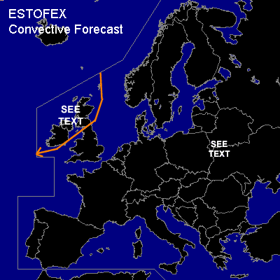
General thunderstorms are forecast across the northwestern British Isles
SYNOPSIS
Southwesterly flow sends a low to Ireland and Scotland, associated with a strong pressure gradient field and ample instability to generate showers with occasional thunder. These are capable of producing gusts over the severe criterion of 50 knots, given the 850 hPa speeds in the trough of 60 kts. With the forecast deep-layer shear of over 40 kts and low level (0-1 km) shear greater than 20-30 kts and fairly low LCLs, an isolated tornado is a possibility. Convection may be organised inside troughs (e.g. UKMO) into linear segments, with an enhanced threat of severe gusts. This situation may qualify for a slight risk, depending on the degree of instability that realises.
DISCUSSION
...Eastern Europe...
High shear environment without clearly ascending motions to be found in GFS, but with some low level instability and low LCL/LFCs. This might be sufficient for an isolated tornado around the Belarus area.
#