CONVECTIVE FORECAST
VALID 06Z TUE 06/01 - 06Z WED 07/01 2004
ISSUED: 05/01 19:44Z
FORECASTER: HAKLANDER
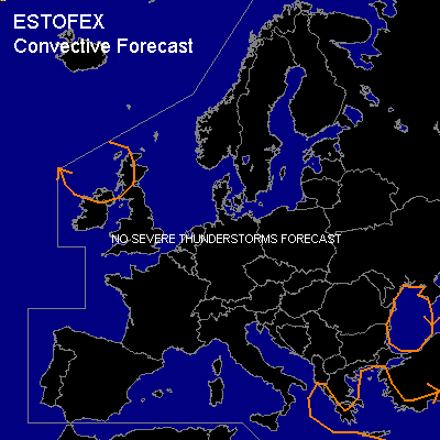
General thunderstorms are forecast across NRN Ireland, WRN Scotland, the Ionean, Aegean, WRN Black and ERN Mediterranean Seas
SYNOPSIS
Wavy upper level flow pattern centered at about 50N gradually progresses EWD. Near the west coast of the Black Sea, a quasi-stationary closed ULL can be found.
DISCUSSION
...ERN Mediterranean and WRN Black Sea
SERN Europe...
A cold pocket of air at mid-levels yields low MUCAPE and some scattered shallow thunderstorms across the relatively warm seas. Due to the absence of significant vertical wind shear, convective activity will most likely remain non-severe.
...NWRN Europe...
Since Monday's GFS12Z run forecasts very moist vertical profiles with MUCAPE > 100 J/kg and EL's above 500 hPa (LI's of -1K), the odd rumble of thunder in this polar air mass cannot be ruled out on TUE morning. No significant vertical wind shear is forecast across this area either.
#