CONVECTIVE FORECAST
VALID 06Z SUN 28/12 - 06Z MON 29/12 2003
ISSUED: 28/12 02:01Z
FORECASTER: GROENEMEIJER
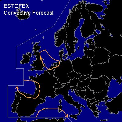
General thunderstorms are forecast across the North Sea and the northern Netrlands and northwestern Germany and across parts of southwestern France, an Northern Spain as well as the southwestern Mediterranean Sea including saouthern Sardinia.
SYNOPSIS
A vigorous shortwave trough over southwestern France and northern Spain is expected to split. Its southern part is forecast to dig into the western Mediterranean, while the northern part lifts northeastward. Another shortwave trough east of Scotland will likely move southeastward approaching the Low Countries and northern Germany. A few thunderstorms are expected in an unstable polar air-mass over the southern Bay of Biscay and additional storms may develop over the southwestern Mediterranean ahead of the southern part of the former trough. Rising motions ahead of the North Sea trough are expected to destabilise the polar air-mass over the North Sea as well, which will probably result in a few thunderstorms as well. Expected wind shear and instability are not expected to be high in any of these areas so that the severe threat is forecast to be low.
DISCUSSION
#