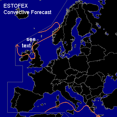

CONVECTIVE FORECAST
VALID 06Z SAT 20/12 - 06Z SUN 21/12 2003
ISSUED: 20/12 00:28Z
FORECASTER: GROENEMEIJER
General thunderstorms are forecast across The northern and western British Isles, the northern North Sea and parts of western Norway as well as Parts of the central Mediterranean including parts of Italy and Greece.
SYNOPSIS
Saturday at 06Z...an intense mid/upper- trough is expected between Iceland and Scotland that will progress rapidly southeastward inducing stron surface cyclogenesis over the British Isles starting Saturday afternoon. A broad north-south oriented ridge is located over the Iberian peninsula. A weak upper trough located over the Tyrrhenean Sea is expected to move southeastward.
DISCUSSION
...northern and western British Isles...
Behind a cold-front, an arctic air-mass is expected to move southeastward and reach northwest Ireland and Scotland some time Saturday morning. Within this air-mass, wintry showers are forecast, some of which will likely be thundery. Lower tropospheric winds are expected to increase on Saturday... 850 hPa winds will likely be in the 35 - 50 kt range. Storms that occur may be associated with gusts approaching the severe limit of 50 kt, and possiby just over 50 kt in coastal areas.
#