CONVECTIVE FORECAST
VALID 06Z MON 15/12 - 06Z TUE 16/12 2003
ISSUED: 14/12 22:51Z
FORECASTER: GROENEMEIJER
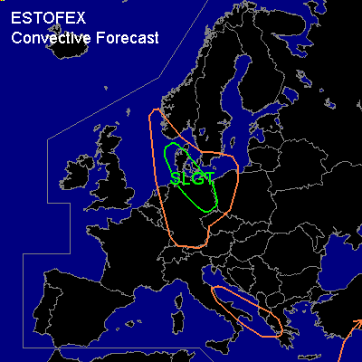
There is a slight risk of severe thunderstorms forecast across parts of Denmark and northern and eastern Germany
General thunderstorms are forecast across the eastern North Sea, Denmark, much of Germany, western Poland and the western Czech Republic, and the northeastern Netherlands as well as parts of southern Turkey and also across eastern Italy and the southwestern Balkans.
SYNOPSIS
At 06Z a longwave trough over Scandinavia has an axis from northern Scandinavia to the northwestern Balkans, that is slowly propagating eastward. Meanwhile the trough is digging southward reaching a line from bortheastern Scandinavia to Romania at the end of the forecast period. On its western flank a polar air-mass is advected southward over central Europe.
DISCUSSION
...Denmark, Germany...
A mesoscale surface trough embedded in the polar air-mass is expected over southern Denmark and north-central Germany at the beginning of the forecast period, working its way southeastward and affecting eastern Germany during the morning hours. It may be followed by one or two similar systems later on Monday.
The systems will likely be accompanied by clustered -locally thundery- showers of snow and graupel. Especially on the southwestern flank of the surface trough the, large scale windfield is expected to be enhanced. The resulting wind field (55-65 kts @ 850 hPa locally) will probably be strong enough for gusts accompanying the showers to exceed the severe limit of 50 kts in several places.
#