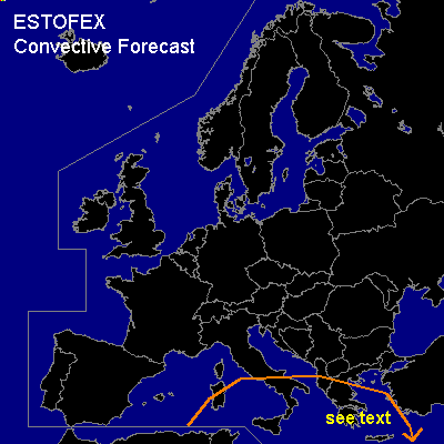

CONVECTIVE FORECAST
VALID 06Z FRI 12/12 - 06Z SAT 13/12 2003
ISSUED: 11/12 17:33Z
FORECASTER: GATZEN
General thunderstorms are forecast across eastern Mediterranean
SYNOPSIS
Well developed westerly flow persists over northern Europe, and embedded short-waves will move eastward. During the forecast period, short-wave trough will cross Central and northeastern Europe. Over the south-central Mediterranean, upper cut-off low will move eastward.
DISCUSSION
...East-central Mediterranean
...
Cut-off low over the south-central Mediterranean will move eastward. At the surface ... associated surface low will weaken. Its cold front should cross the south-central Mediterranean till tomorrow morning and low level cold air advection should lead to stabilization. NE of this cold front ... relativly warm airmass will spread westward reaching Greece and southern Italy. Although no soundings are available that indicate the vertical profile of this airmass ... surface observations do not suggest rich low level moisture, and CAPE should be rather weak. Over the central Mediterranean ... stratiform precipitation should likely occur but embedded thunderstorms are not ruled out. Strong convection is not forecast due to weak instability. Over eastern Mediterranean ... delta of southerly flow pattern will exsist over Greece ... and synoptic scale lift is forecast. CAPE is expected to reach some 100s J/kg or more if steep lapse rates originating from northern Africa would be involved. Thunderstorms should develop during the day. As vertical wind shear will be moderate due to easterly surface winds and southerly winds aloft ... some thunderstorms may rotate producing hail and probably a brief tornado. Overall thread seems to be too low for a slight risk.
#