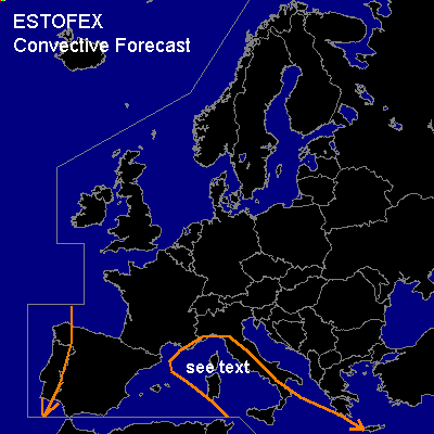

CONVECTIVE FORECAST
VALID 06Z FRI 07/11 - 06Z SAT 08/11 2003
ISSUED: 06/11 18:02Z
FORECASTER: GATZEN
General thunderstorms are forecast across central Mediterranean, western Iberian Peninsula
SYNOPSIS
Well developed high-over-low block will affect the forecast region during the periode ... with a high over Scandinavia and a cut-off low over the Alpine region digging westward.
DISCUSSION
...Central Mediterranean...
Upper cut-off low will move slowly eastward. To the south ... relatively strong jetstreak affects the central Mediterranean. Embedded vort-max is forecast west of Italy at the end of the forecast periode. As cold air advection will be rather weak, associated DPVA should lead to strong synoptic scale UVM. Affected airmass should be characterized by relatively rich low level moisture as indicated by today's soundings and CAPE could possibly reach some 100s J/kg underneath the trough axis. During early Saturday morning ... thunderstorms should develop along the trough axis affecting western Italy at the end of the forecast periode. This thunderstorms will possibly be strong as low level shear /southwesterly 850 hPa-winds above easterly surface winds/ will promote organization of bow echoes and shallow mesocyclones. Therefore the potential for tornadoes and severe wind gusts should be slightly enhanced; overall threat seems to be too low to warrant a SLGT RISK though.
#