CONVECTIVE FORECAST - UPDATE
VALID 13Z THU 02/10 - 06Z FRI 03/10 2003
ISSUED: 02/10 14:01Z
FORECASTER: GROENEMEIJER
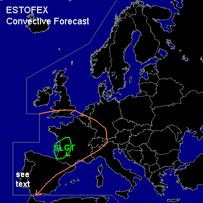
There is a slight risk of severe thunderstorms forecast across southwestern France
General thunderstorms are forecast across extreme southern England and much of western continental Europe.
SYNOPSIS
A SW-NE oriented trough is located over extreme western Europe as a sharpening and developing upper level trough approaches the British Isles. At 12 Z...water vapour imagery indicated a shortwave trough over the southern Bay of Biscay and north-central Spain... and a vorticity maximum was located approximately 300 km west of Lisboa.
DISCUSSION
...Southwestern France...
Modifying the Bordeaux sounding for a surface temperature of 25 C and a dew point of near 18 C, shows that locally MUCAPE is in the 500 - 1000 J/kg range. On approach of the shortwave trough from the Bay of biscay, storms are forming over the coastal regions of southwestern France. Given the presence of quite high (~20 kt) 0-1 km shear and about 40-50 knots shear in the lowest 3 km... storms will likely organise into small bow-echoes capable of producing gusts well in excess of 50 knots and large hail. A few rotating updrafts may be embedded within the line, yielding a small chance of tornadoes, given the high low-level shear and around 1000m LCL heights.
...central and southern Portugal, western Andalucia...
As the second vort maxes approaches linear convection will especially affect the coastal areas. Locally...a few strong wind gusts mostly below the severe limit of 50 knots will be possible.
...The Channel, Northern France, Western Germany, southern Benelux...
Overnight... in response to the approaching trough from Western France some thunderstorms may develop in addition to non-convective areas of rain as some latent instability might have developed locally. This convection is not expected to be severe, though a few stronger gusts might occur over southwestern Germany and northeastern France, as winds will likely be near 25-35 knots at the top of the boundary layer in those areas.
#