CONVECTIVE FORECAST
VALID 06Z MON 29/09 - 06Z TUE 30/09 2003
ISSUED: 28/09 23:37Z
FORECASTER: GROENEMEIJER
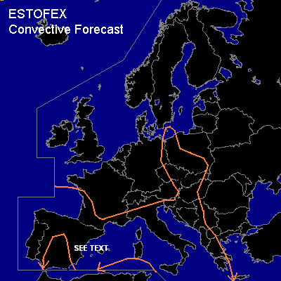
General thunderstorms are forecast across parts of Poland, the Czech Republic and Slovakia, the Adriatic region, the western and central Mediterranean Sea and its surroundings, western and northern Iberia, southern France and the Bay of Biscay.
SYNOPSIS
A N-S oriented mid/upper trough is located near a line from western Germany to the Thyrrenean Sea on Monday at 06Z. It is expected to move will move eastward reaching a line from central Poland to the central Balkans 24 hours later. Rising motions ahead of the system are and will likely continue to sustain some thunderstorm within the weakly unstable air-mass present over and near the Mediterranean Sea. Limited instabiliy and wind shear will likely prevent these storms from becoming severe. Some scattered possibly thundery storms may form over central Europe as well. Behind the trough, a ridge is forecast to build over western continental Europe. On approach of a new Atlantic mid/upper trough, areas of rising motion may initiate some storms affecting western and Iberia, the Bay of Biscay and southern France during the evening and overnight.
DISCUSSION
...Eastern Iberia, western Mediterranean...
A small, weak trough or closed low is forecast to form in the lee of the Iberian peninsula near Valencia. Convergence of the air-mass present will likely enable the slight instability that is present (~ 500 J/kg) to be resleased in couple of thunderstorms. Storms will likely form over Sea, but also over the eastern parts of the peninsula. Moderate (35-45 kt 0-6 km) deep-layer shear will aid clustering of storms into mulitcells and possibly one or two supercells. Some hail and strong wind gusts may occur, but overall threat will be relatively small given that instability, shear as well as forcing for upward motion are all quite marginal.
#