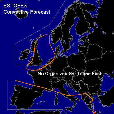

CONVECTIVE FORECAST
VALID 06Z FRI 26/09 - 06Z SAT 27/09 2003
ISSUED: 25/09 17:20Z
FORECASTER: GATZEN
General thunderstorms are forecast across northwestern Europe
General thunderstorms are forecast across western Mediterranean
SYNOPSIS
Upper ridge placed over Central Europe. Short wave troughs are situated over eastern Europe and northwestern Europe. Over the Mediterranean ... weak upper trough will remain. At lower levels ... Central European high will move eastward, as short wave trough and associated cold front are forecast to cross northwestern Europe during the forecast periode.
DISCUSSION
...Northwestern Europe...
Cold front is expected to cross Great Britain. Ahead of this front ... soundings do not indicate CAPE. Tomorrow ... thunderstorms seem to be not likely as CAPE should remain below 100 J/kg ... and convection should be rather shallow. However ... relatively strong vertical shear south of the main trough /60 kts @ 300 hPa at 18Z) and associated synoptic scale forcing could lead to some thunderstorms, as the cold front moves east during the day. Some strong wind gusts and one brief tornado or two are not ruled out if storms will organize ... however ... chance seems to be too low to warrant a SLGT RISK.
#