CONVECTIVE FORECAST
VALID 06Z THU 14/08 - 06Z FRI 15/08 2003
ISSUED: 13/08 22:08Z
FORECASTER: GATZEN
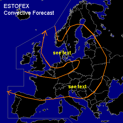
General thunderstorms are forecast across Central Europe, North- and Baltic Sea
SYNOPSIS
Short wave has reached Scandinavia, where intense upper trough will remain. Strong surface low is forecast in association with this feature tomorrow. To the south ... cold front has reached the Alps, and Central European heat wave has ended.
DISCUSSION
...Northern Central Europe...
In the range of upper short wave trough ... cold airmass will likely destabilize above the warm water surface of the North Sea and Baltic Sea. Showers and thunderstorms should develop over the North Sea during the night and go on tomorrow. Activity is expected to move eastward in the day. Benard-type convection should be the convective mode. Some of the storms should likely produce strong to severe wind gusts, as strong upper jet and strong surface winds due to forecast surface pressure gradient will be in place. There is a slight chance that those wind gusts will be rather widespread, but latest model output does not suggest this scenario.
...Southern Central Europe...
Cold fronts will be the focus of convective activity, and thunderstorms should develop during the day, initially where orographic features will be favorable. The southernmost cold front will remain from central France along the northern Alps to Austria, while another cold front/ upper trough will reach central Germany. Along those fronts ... low level moisture pooling is expected ... and CAPE should reach some 100s J/kg during the day. As upper level winds will increase, vertical shear could be favorable for organized convection. Most thunderstorms should be weak, but there is a slight chance that we will see some stronger cells/ mesocyclones with associated large hail, strong wind gusts and probably a brief tornado. Risk for severe convevction seems to be quite low though. In the evening ... convective activity should spread southeastward ... where mid-level steep lapse rates should create CAPE of more than 1000 J/kg. Large hail and damaging wind gusts will be more likely than. Strongest activity is expected over the northern and central Balkans, where an upgrade to SLGT could be necessary.
#