Mesoscale Discussion
Valid: Wed 18 Sep 2024 19:00 to Wed 18 Sep 2024 23:00 UTC
Issued: Wed 18 Sep 2024 19:08
Forecaster: TUSCHY
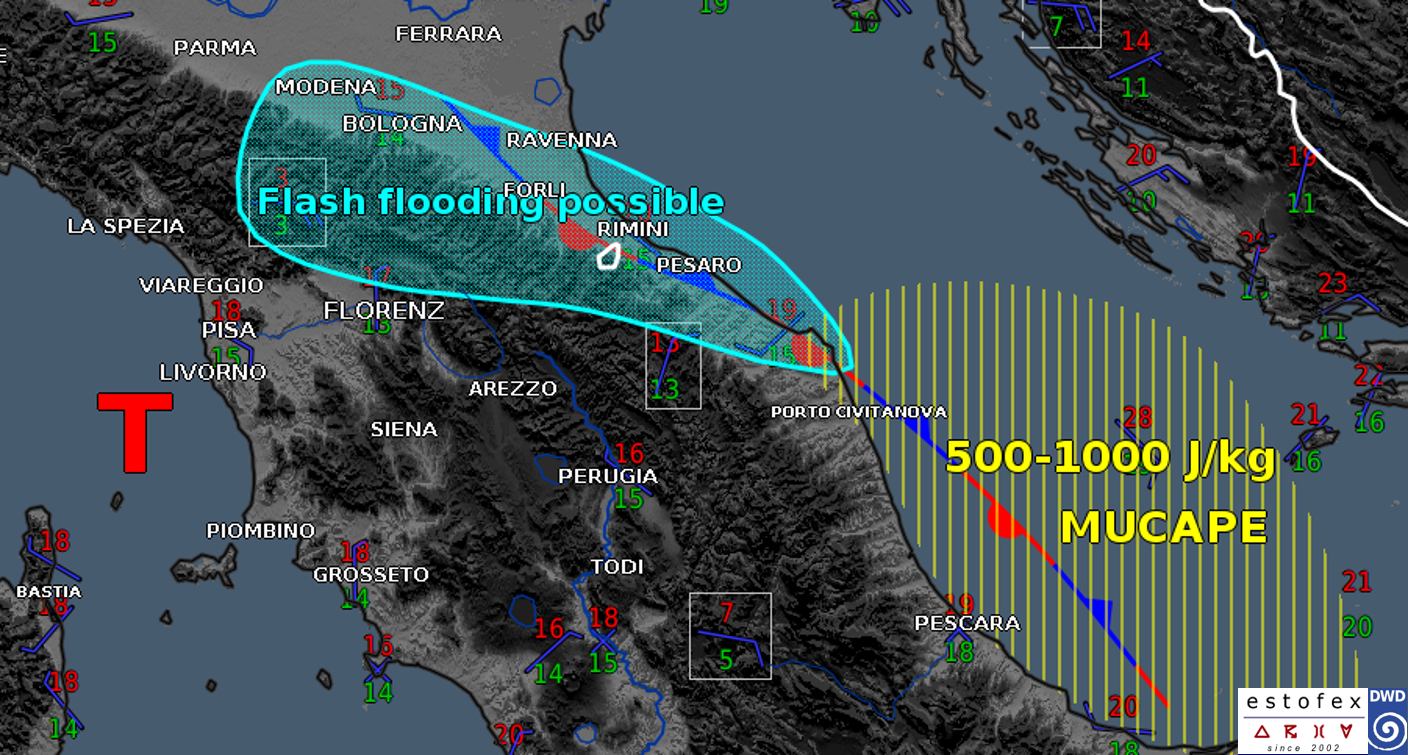
A Mesoscale Discussion (MD) was issued to highlight the risk of excessive rain.
Enhanced BL convergence is now in progress over the W/NW Adriatic Sea with a wavy/quasi-stationary boundary rooting into 500-1000 J/kg MUCAPE offshore.
A deep/3km warm cloud layer exists in local AMDARs, which supports efficient rainfall production (collision coalescence process). 12h amounts in the mountainous areas are already in the 150-200 l/qm on the regional scale (S.Cassiano sul Lamone roughly 220 l/qm, Trebbio with roughly 140 l/qm) with coastal areas S of Rimini more in the 50-70 l/qm range. Hourly amounts were more in the 30-45 l/qm/h range (a station S of Rimini with 179 l/qm/h seems messy). With the eastbound shift of the upper low in response to the ongoing Fujiwhara effect, deep confluent flow regime increases and persists throughout the night.
Latest high resolution models indicate additional 50-150 l/qm with highest peaks probably next to the orography and along the coast. NWP guidance remains divergent regarding hot spots but most models have peaks in the hatched area.
Missing BL mass response/weak LL flow keeps final rainfall amounts probably in check. In addition, any shift of the BL winds also pushes the band with repeated convection S/N.
Flash flooding on the local scale is possible. In addition a few spouts/tornadoes along the coast next to the vorticity-rich boundary seem possible.
Next to the Gulf of Follonica beneath the vortex' center, quasi-stationary cells also pose a risk of local flash flooding including a few spouts/tornadoes.