Mesoscale Discussion
Valid: Wed 16 Sep 2020 09:00 to Wed 16 Sep 2020 21:00 UTC
Issued: Wed 16 Sep 2020 09:05
Forecaster: ESTOFEX
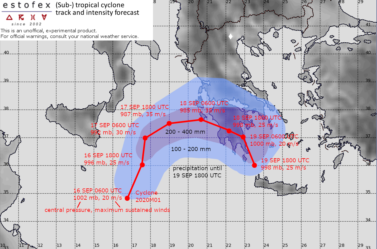
A Mediterranean convectively-driven cyclone has formed across the Central Mediterranean Sea. At 06 UTC, the Dvorak method for estimating storm intensity yields a T-number between 2.5 and 3. This suggests an approximate central pressure of around 1002 mb and sustained wind speeds of around 20 m/s.
A forecast track and intensity evolution based on a consensus of numerical weather prediction models including GFS, ECMWF and ICON is presented in the graphic.
The models are initially in fairly good agreement and predict a rather quick intensification during the next 36 hours until above hurricane speed, aided by high sea surface temperatures near 27C and a lack of relatively dry air at mid-levels.
The models start to diverge late on Thursday and on Friday when ICON steers the cyclone towards Northwestern Greece, while ECMWF predicts landfall on the Peloponnesos, and GFS keeps the cyclone just offshore before it turns to a southeasterly track.
Regardless of the exact scenario, very high accumulations of rain, locally between 200 and 400 mm are expected across the Peloponnesos and possibly parts of Central Greece and Attica late on Thursday, Friday and Saturday.
