Mesoscale Discussion
Valid: Wed 16 Sep 2020 20:00 to Wed 16 Sep 2020 09:00 UTC
Issued: Wed 16 Sep 2020 20:30
Forecaster: ESTOFEX
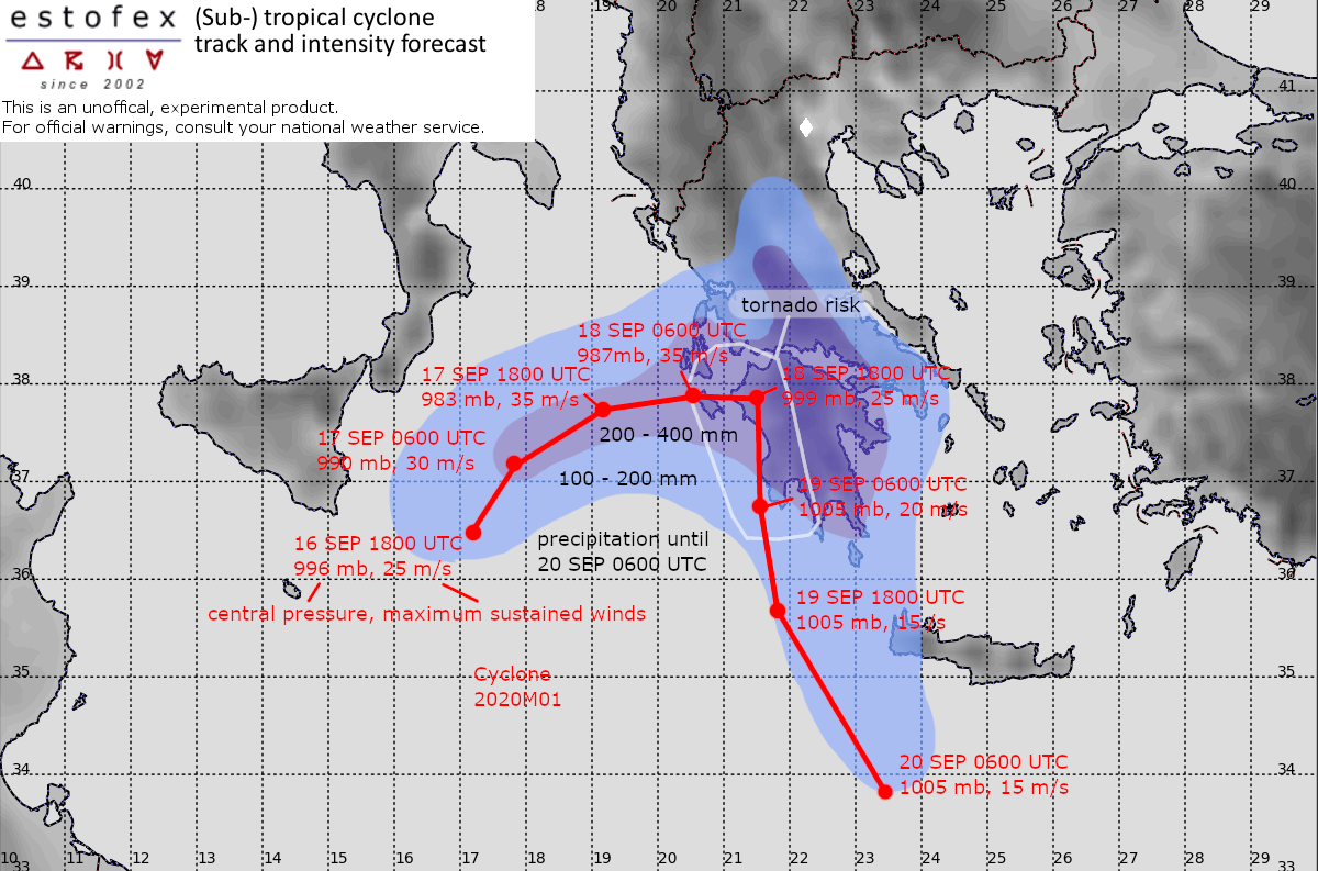
The cyclone has drifted northward durign the day and slowed down. At the same time its satellite representation has improved, and has strenghtened. ASCAT scatterometer data indicate sustained wind of around 45 kts, 22.5 m/s to the west of the center. The surface pressure is estimated to have dropped to near 995 mb.
The forecast track is shifted a little northward until reaching the coastal region of western Greece. The GFS and ECMWF strongly weaken the cyclone around this time, but both models expect a much weakened cyclone to move southward on Friday evening as it moves out to sea again offshore. The ICON model, which has the most northerly track dissipates the cyclone after making landfall.
The models are in good agreement and predicting a rather quick intensification during the next 24 hours until above hurricane speed. This intensification is probably aided by the weakening of wind shear that has resulted in a rather asymmetric cyclone until now, with most convection confined to the north and west of the centre.
Regardless of the exact scenario, very high accumulations of rain, locally between 200 and 400 mm are expected across the Peloponnesos and possibly parts of Central Greece late on Thursday, Friday and Saturday. They will lead to serious flash flooding in many areas.
Because strongly curved and long hodographs will develop along the eastern flank of the cyclone, there will be a risk of tornadoes across the western Peloponnese in association with embedded storms from Thurday evening onward.
