Mesoscale Discussion
Valid: Fri 10 Jul 2020 18:00 to Fri 10 Jul 2020 22:00 UTC
Issued: Fri 10 Jul 2020 18:24
Forecaster: GROENEMEIJER
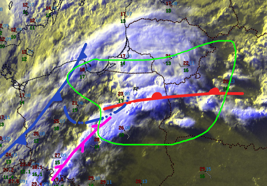
A line of supercells some of which exihibit hook echoes are ongoing in the west of the indicated area, where strong low-level shear is present courtesy of a 15-20 m/s SWly winds at 850 mb and weak surface winds. Additional storms may develop in the likewise strongly sheared, but marginally unstable airmass over North-Central Poland.
Strong low-level rotation is likely and a marked risk of potentially strong tornadoes exist with these storms as they track eastward, along with a risk of large hail and severe wind gusts.
NWP guidance indicates that CAPE will decrease during the period, however mixed boundary-layer parcels should continue to be potentially buoyant, so that storm activity may diminish only very gradually. At the same time, low-level shear should increase further, with SRH0-1 in the 200-400 m/s range over South Lithuania and North and West Belarus, indicating that a risk of strong tornadoes will persist with any supercells that survive into the late evening.
