Mesoscale Discussion
Valid: Wed 05 Jun 2019 17:00 to Wed 05 Jun 2019 20:00 UTC
Issued: Wed 05 Jun 2019 16:42
Forecaster: GROENEMEIJER
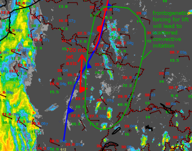
Strong frontogenetical forcing for upward motion is commencing over the MD area as a sharp cold front over eastern France reorients itself in association with pressure falls over the Saone Valley region. In response, coverage of convective clouds, both elevated and surface-based is increasing.
Until 20 UTC, a number of storms are expected to develop, which given the low relative humidity will likely be of an elevated or high-based nature. Despite marginal CAPE, some cells may develop rotating updrafts courtesy of the strong wind shear aided by a 25 m/s mid-level jet at 700 mb. A few hail and severe wind events may result.
As the convection evolves, a strong cold pools are forecast due to the extensive evaporation of hydrometeors below cloud base. In the 19-20 UTC time frame, interaction with the shear may ultimately lead to linear or bow-echo type structures to move into Luxembourg, Luxembourg and Liege provinces and the Rhineland-Palatine per model guidance, with an attendant increasing severe wind risk.
