Mesoscale Discussion
Valid: Tue 29 Sep 2026 15:00 to Wed 30 Sep 2026 06:00 UTC
Issued: Tue 29 Sep 2026 01:57
Forecaster: TUSCHY
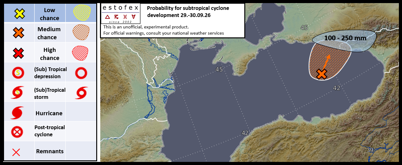
A medium chance for subtropical cyclone development over the E Black Sea.
During the past 24h, a NE ward lifting upper vortex assisted in a broad/diffuse LL vortex spin-up atop the E Black Sea. This vortex now resides in a plume of moist and unstable air but latest remote sensing data indicates convection well displaced from the vortex' center.
However, some tightening of the LL vortex is forecast during the day both due to frictional induced vorticity streamers along its NE fringe spiraling into the structuring vortex but also due to improving upper divergence ahead of another cold-core vortex, which draws near from the N during the night.
SSTs run near normal with an increase towards the coasts (1-2K positive anomalies). A general increase in convective activity is forecast from the late afternoon onwards and there exists a short window of opportunity for this convection to evolve near/or wrap around the center before landfall is forecast during the end of this forecast.
A medium chance for subtropical cyclone development during the forecast period is anticipated and we could see a ST 1.5 classification with the main risks being gusty winds and heavy rain (locally up to 250 mm in 36h) along its periphery.
Beyond this forecast period, the vortex seems to move back towards the E Black Sea before drifting SE towards Georgia with another chance of acquiring temporal criteria for subtropical cyclone classification on Thursday.
